Constantly changing requirements in the planning industry have led to ever more onerous demands with respect to detail required in support of development proposals.
Helped by advances in technology however, these new demands pose no problem to the surveyors at Dorset Land Surveying.
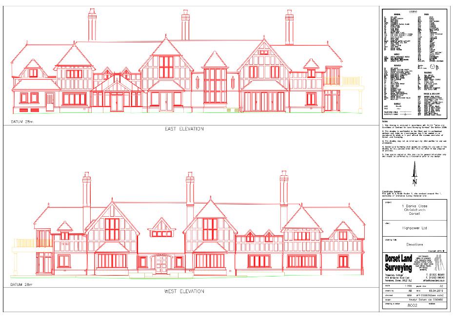
The latest reflector-less total station theodolites and scanning technology allow us to map your street scene and elevation requirements with ease and accuracy even where foreground obstacles such as foliage and other buildings obstruct the view of the elevation on the ground.
Dorset Land Surveying can laser map even the most intricate elevations to produce a full 3D digital model, enabling views to be generated orthogonal to any desired line or, in the case of curved elevations and street scenes, reconstructed to show the true face elevation at any given radius.